“Who Were Angie and Kirsty”
More about today’s title further down! Here are the Day 04 stats:
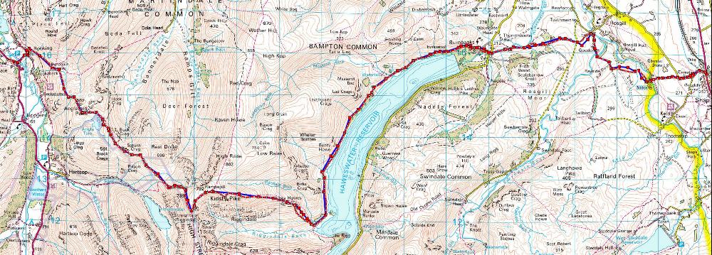
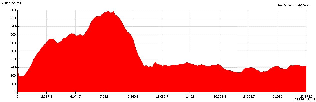
| Left Patterdale: | 09:30 | Arrived Shap: | 16:50 |
| Distance (kms): | 25.50 | Distance (mls): | 15.94 |
| Moving Time: | 6:40 | Minimum Altitude (m): | 153.9 |
| Stopped Time: | 0:40 | Maximum Altitude (m): | 792.7 |
| Moving Average (kph): | 3.8 | Total Ascent (m): | 1,062.3 |
| Overall Average (kph): | 3.4 | Total Descent (m): | 1,041.1 |
Day 4 GPX file: c2c04 (right mouse click and “Save link as…”) – as before, includes the route I should have taken as well as the actual route! There was just one small, but major, deviation which could have been, well, a slight problem!
Till I Reach My Highest Ground
So, all you clever people out there, who wrote and had the hit with the song that includes the lyric “Till I reach my highest ground“? A very valuable prize to the first person to mail me the answer!
The reason for today’s subtitle, rather than the main “Who Were Angie and Kirsty” is that this is the leg of the C2C which reaches the highest point at 780 m (my GPS reassuringly wasn’t too far out at 792.7 m) and is also the longest leg so far, although not according to 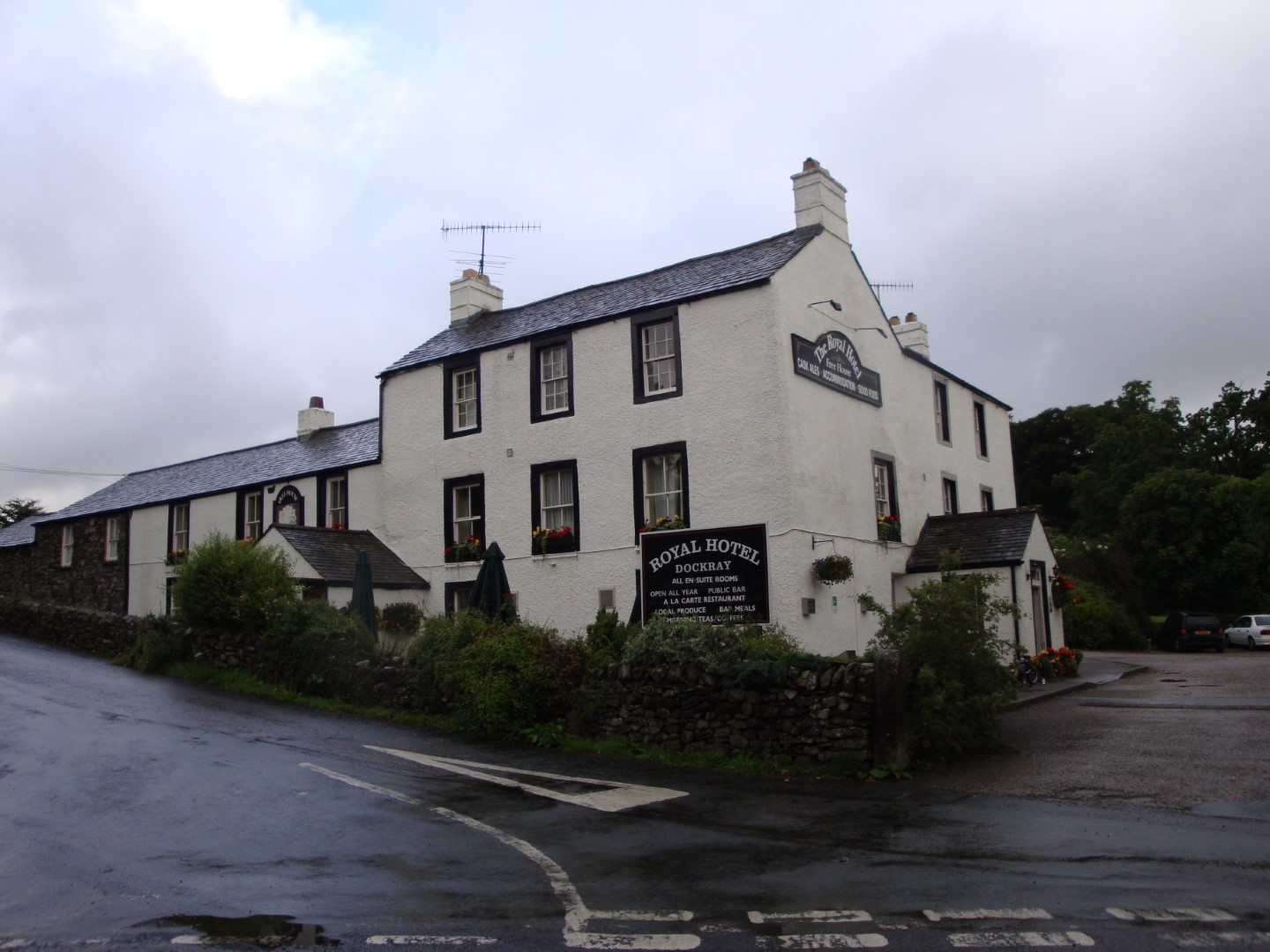 the route I’d taken from Rosthwaite to Patterdale! After the instantly forgettable breakfast at The Royal Hotel, Dockray, my darling drove me back to the Patterdale Hotel for the start of today’s supposed 24 km to Shap and the end of the Lake District section of the C2C which, if the weather had been better, would have been specially spectacular. In my hurry to get on with today’s walk we forgot to take the early morning photo of me posing outside the pub – but don’t worry, folks, it was the only time this happened during the whole walk! In fact, the weather wasn’t too bad at “Patterdale level” but the tops of the fells were covered in swirling mist and there was no way that the sheep would get the benefit of viewing my legs today!
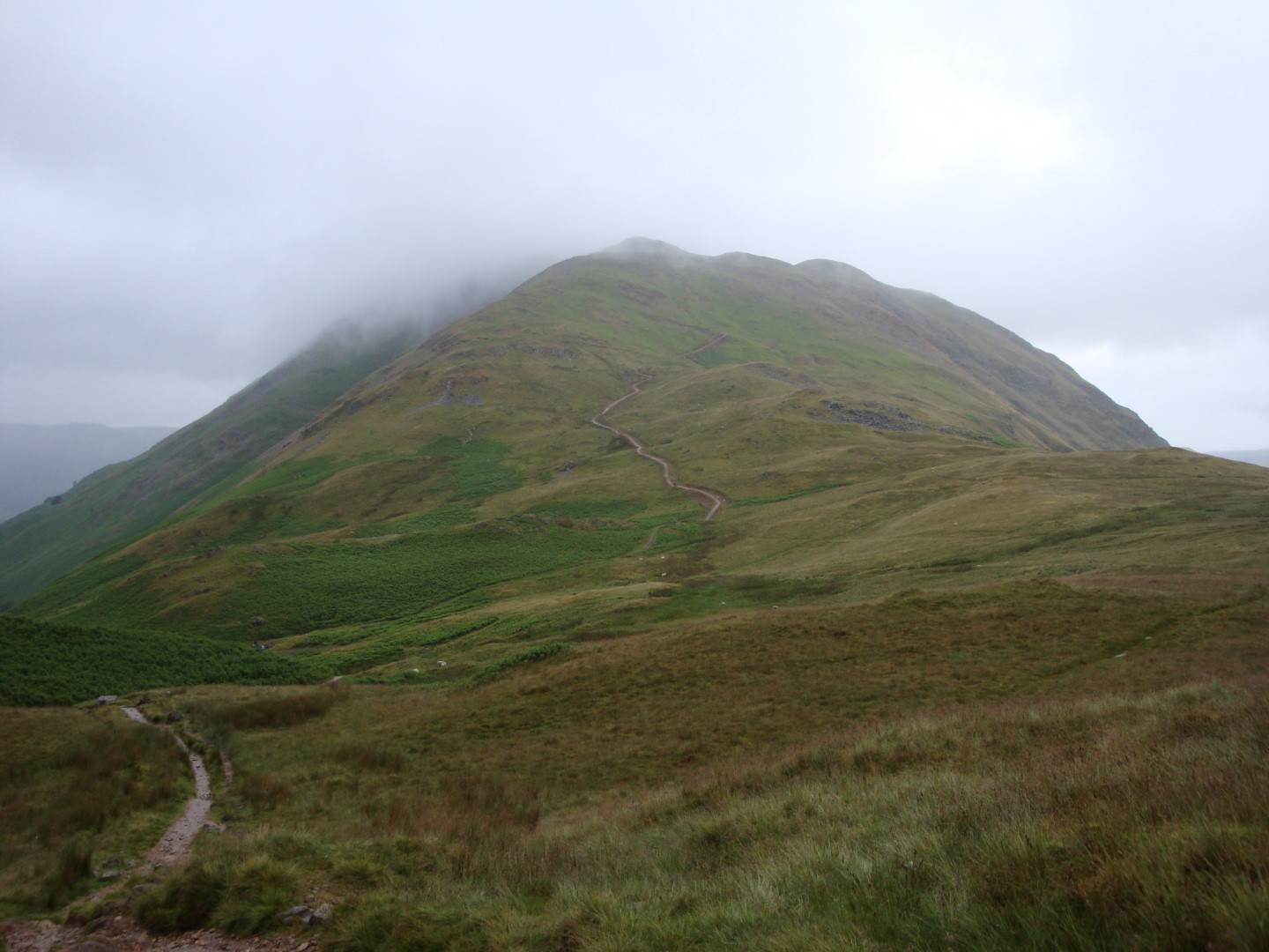 As I walked out of the village, away from the road and onto the fells it became windier and windier and mistier and mistier. On the climb to Boredale Haus I passed a party of Eight Sheilas (ladies of a “certain age” from down under) some of whom were struggling a bit with the wind, rain and gradient (they weren’t the only ones!). I got chatting to one of them and asked why they’d come all the way from Australia to do the C2C, especially since the weather can be as it was today. They weren’t in the slightest concerned about the rain and wind, reckoned that there wasn’t anything like the C2C in Australia, were delighted to be doing it and since Brisbane to Perth is about 4,000 km our C2C is somewhat easier than the Aussie one! One of their number, however, was struggling a bit and was being “packhorsed” to Shap.
 I continued climbing in worsening weather and came upon what I’d thought to be “Angie’s Tarn”. Of course, I’d looked at the map without my specs on and it’s actually Angle Tarn. I was somewhat disappointed at this, thinking that the small body of water had been named after one of the Stones best songs. Angle Tarn, in good weather, must be very beautiful, but in a howling gale with a mixture of horizontal rain and mist, its charm was somewhat lacking, to say the least. Amazingly, on a promontory sticking out into the tarn were a couple of tents being buffeted by the weather and even more surprisingly, when I looked back after passing by, two people emerged from them. Unbefuckinglievable!
With the rain still torrential and the howling gale blowing it into my face (hey, what about the advice to walk the C2C west to east so that the prevailing winds are at your back?) I reached a stream, probably Sulphury Gill, which was rather too wide to cross. So I walked upstream a bit to where it was narrower and, gazelle-like, leaped across. Except that I didn’t (leap across gazelle-like, that is); in fact I landed on a slippery rock and ended up waist deep in the bloody stream. The cold, wet, windy air was blue with my expletives. Until then, despite the weather, I’d been relatively dry and my feet, although damp, were at least warm. Now I was soaked from the waist down in what seemed like ice cold water and even Brasher GTXs when new won’t keep the water out when it goes over the top.
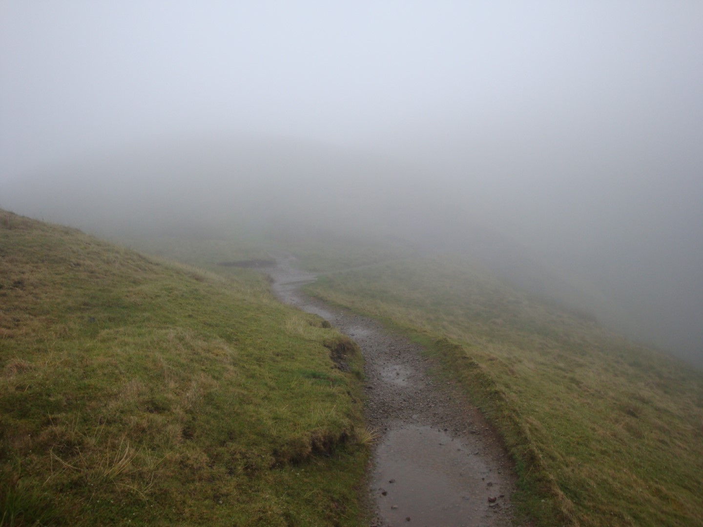
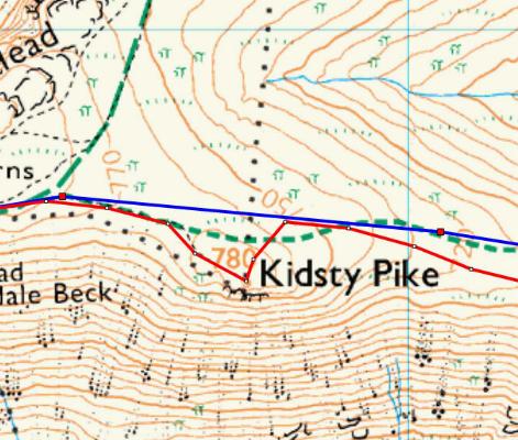 However, I continued climbing, but in almost “white out” conditions, and reached what I had thought to be “Kirsty Pike” which, when looking at the map more closely, turned out to be Kidsty Pike; another mystery solved! I’d gone away a bit from the route my Garmin was prompting me to take but I followed what I took to be the C2C path. Quite suddenly the mist seemed to get very thick indeed, so I proceeded with some caution. Just as well, because I’d reached the top of Kidsty Pike alright, but I was just about to walk over the edge and that might have been just a tad painful and curtains for Johnny! Quickly retreating and heading north I actually overshot the GPS route a bit but soon found my way back on the proper path and religiously followed the track I’d plotted on the Garmin until I could actually see where I was going. Not a bad plan, methinks!
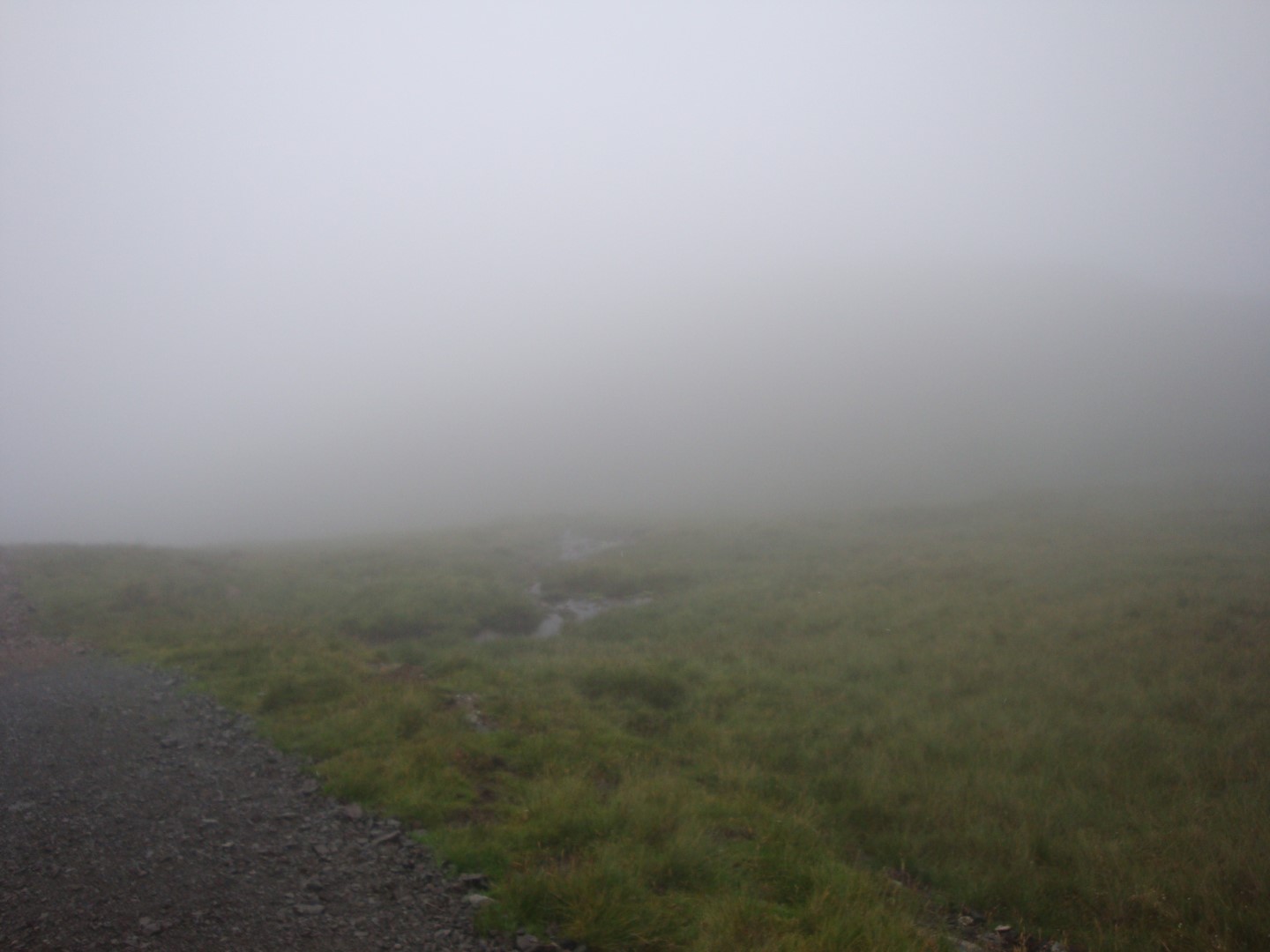 From Kidsty Pike you’re supposed to be able to get the only view in the Lake District of the whole of Ullswater, my favorite of all the large lakes. But, being unable to see more than about 25 m in any direction the views were, to say the least, slightly underwhelming! Still in crap weather, the way began to descend down a path much easier on the feet and ankles than yesterday and as I followed it the rain and wind began to diminish so that by the time I’d reached
 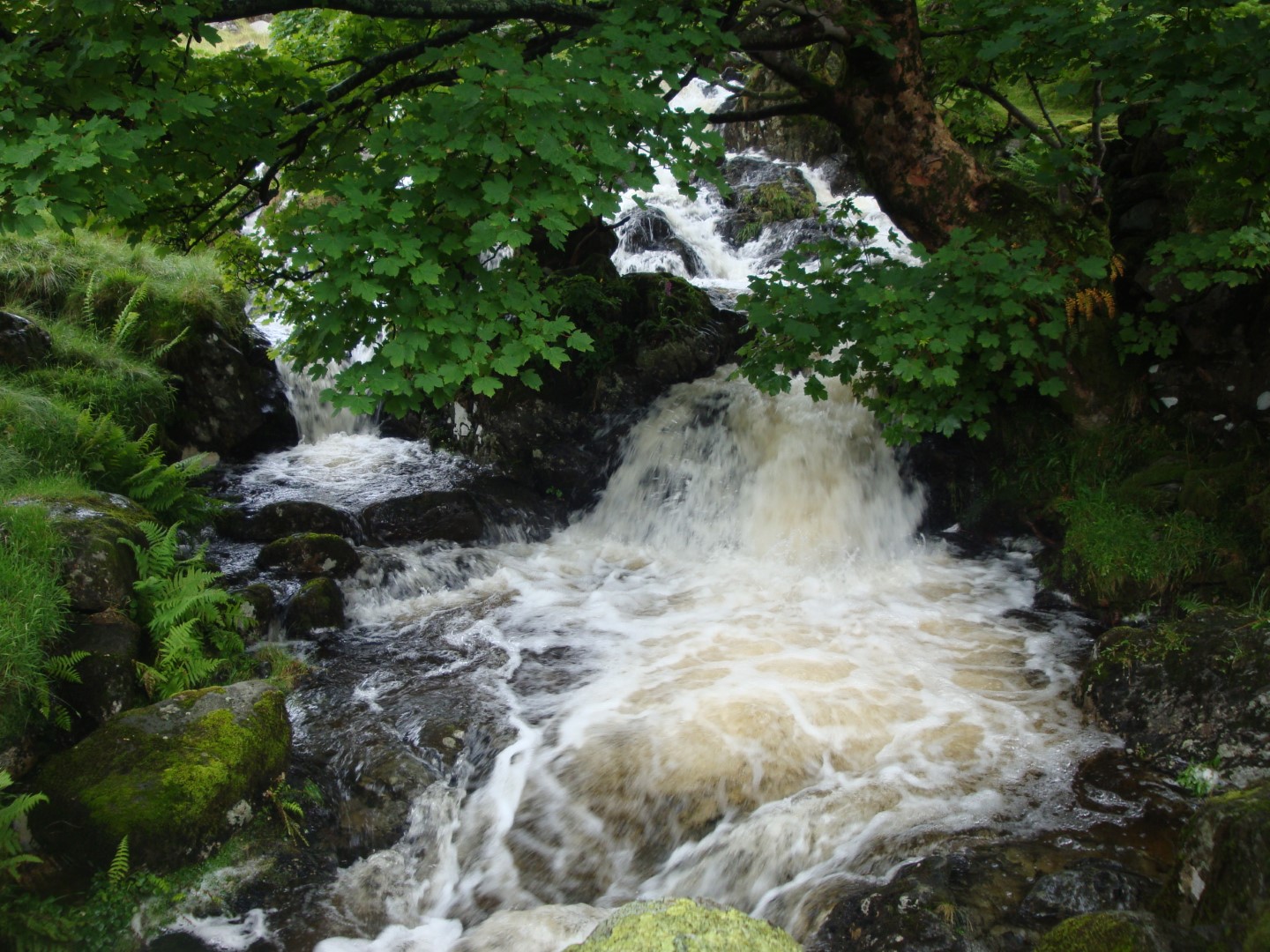 Haweswater at the footbridge over (I think) Randale Beck it was quite pleasant. Here, for the first time I met the guys and gals of the North West Walks group. NW Walks is a small company that provides guided walks over some of England’s northern long distance footpaths and this group were mainly Aussies and Yanks with at least one Canadian and an English-living French woman thrown in for good measure. These were the first walkers I’d encountered since passing the Eight Sheilas earlier in the day but they were leaving as I arrived (was it my wet body odour after falling in the stream?!) so I bade them “cheerio” and stopped for my lunch in relatively good weather, although I was wet, wet, wet!
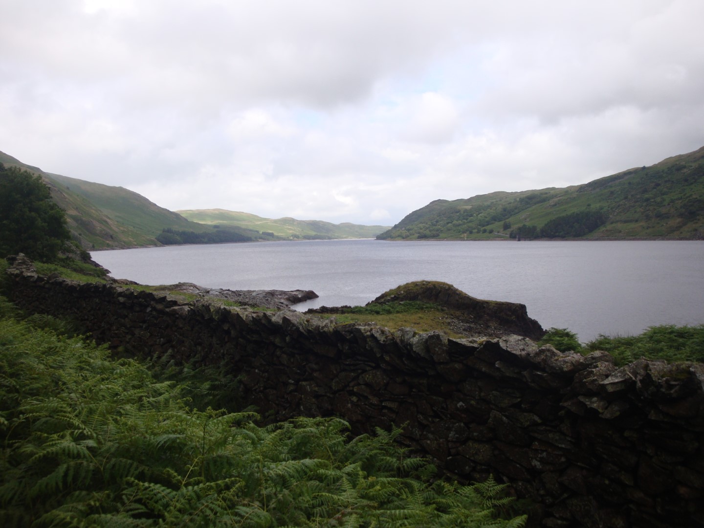
 After lunch I continued along the western shore of Haweswater, a reservoir built by Manchester City Council with great protests from the locals. Well, it did drown their homes and at least one village, so I believe! In still improving weather the views along this artificial lake became quite lovely and I began to divest myself, first of my waterproof jacket and then my gaiters. Of course, as soon as I had done so the rain began again. So it was on, off, on, off… with the waterproof jacket all the way along the lake.
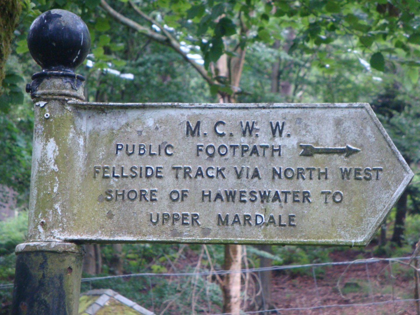
Eventually I reached Haweswater Village and saw the first C2C sign since Cleator on Day 01. It seems that they don’t like or allow such signs in the Lake District itself. At Naddle Bridge I caught up with the NW walkers and chatted to them for a bit, then carried on ahead of them. I suppose that one of the problems with walking in a group such as they were doing is that you have to walk at the pace of the slowest walker, which would drive me crazy and is one of the reasons why I don’t at all mind walking on my own. Mind you, old Goughie is getting close to my pace these days, so he’s quite a good companion for a long walk!
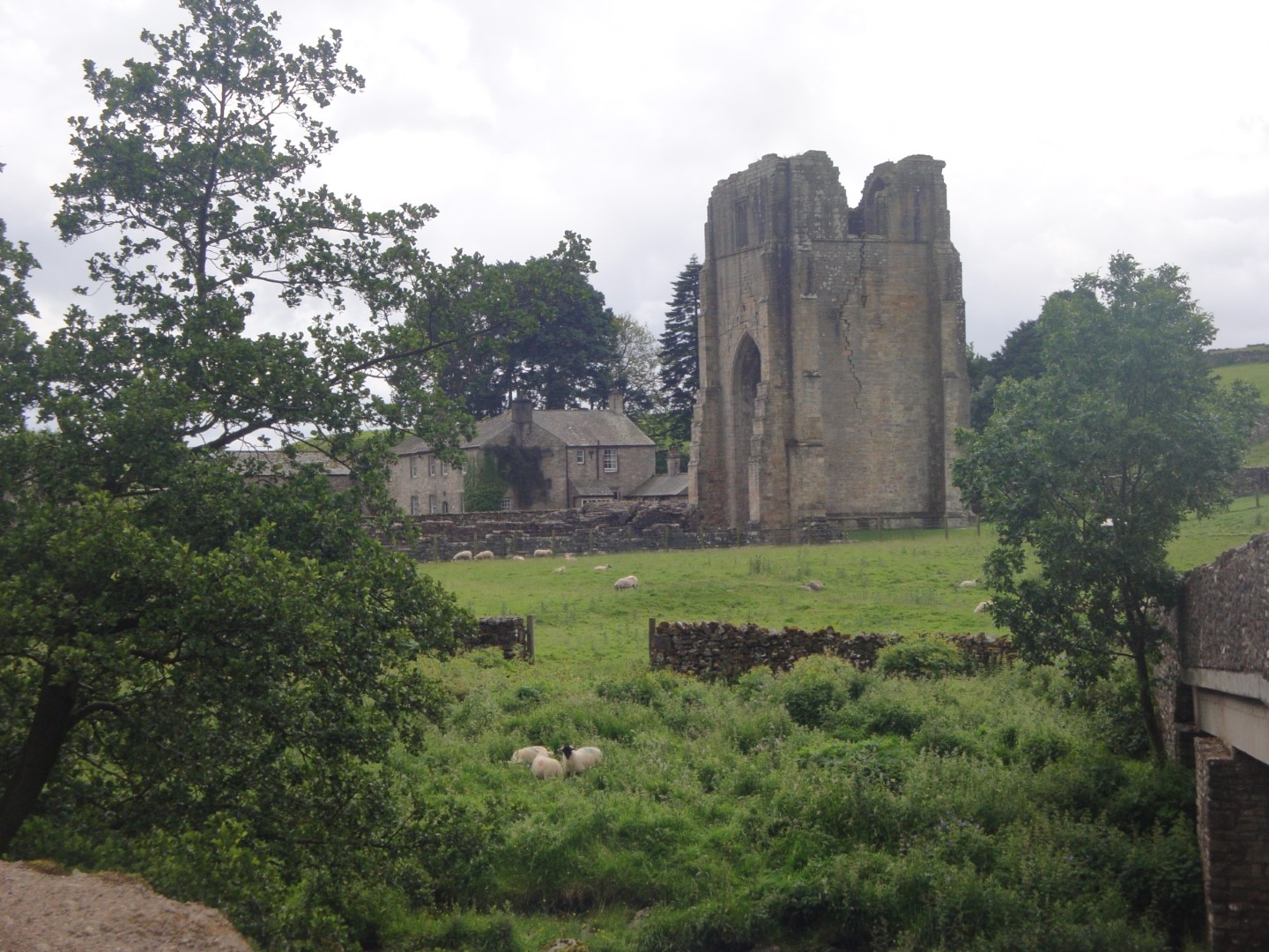 After Haweswater the going was relatively easy, mostly across farm land. Just outside Shap I stopped to take a look at the ruins of Shap Abbey, which was (mildly) interesting and shortly afterwards I reached today’s destination, New Ing Lodge, just as I reached the A6 at the north end of the village. I was there for quite a while before The Boss arrived and Sheila (or “a Sheila”) made me very welcome in our extremely large, although rather spartan, room even getting me some Radox so that I could soak in the bath to ease away the aches and pains of what had been a wet, cold, uncomfortable but nevertheless very satisfying day. New Ing Lodge is different from other B&B’s we’ve stayed in. It’s owned by a young guy, still in his twenties, I think called Scott and he, with his brother and Sheila’s help, are turning what used to be a very big old farmhouse into a B&B specifically for walkers, climbers, cyclists, etc; in fact anyone with almost any kind of sporting inclination. What it lacks in finesse, and they admit that they’re not trying to create a luxury 4 star B&B, they certainly make up for in friendliness and helpfulness with my very wet boots soon stuffed with newspaper and committed to the top of the boiler to hopefully dry.
For dinner we went to the other end of the village, to the Greyhound pub and met our friends Tony and Natalie, who live not far away. It was great to take a break from maps, photos, GPSs, other walkers etc. and speak to “real” people (well, Natalie is, anyway!). After a year we had a lot of catching up nattering to do, with the females’ tongue wagging taking up at least 90% of it (oh, I’m in die Scheiße now!). The beer was excellent and the food great too. All too soon it was time to go and we bade au revoir to T&N, headed back to New Ing Lodge and a very good night’s sleep.
| Accommodation | Beverages & Comestibles |
|---|---|
| New Ing Lodge Shap Cumbria CA10 3LX http://www.newinglodge.co.uk | Braised beef Boiled new potatoes Veggies (very good ~8/10) Jennings and Black Sheep Bitters (3 pints in all - excellent!) |
Some Day 04 Photos