“Say One for Me!”
Today’s title has a rather strange connotation (see below, as usual). Here are the Day 05 stats:
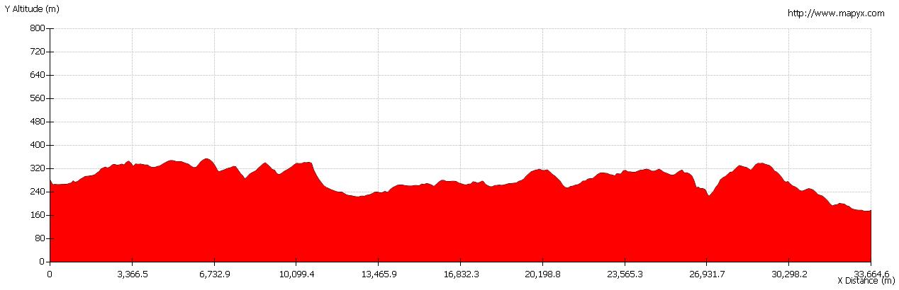
| Left Shap: | 09:05 | Arrived Kirkby Stephen: | 17:00 |
| Distance (kms): | 35.40 | Distance (mls): | 22.12 |
| Moving Time: | 7:09 | Minimum Altitude (m): | 174.1 |
| Stopped Time: | 0:46 | Maximum Altitude (m): | 354.4 |
| Moving Average (kph): | 4.9 | Total Ascent (m): | 705.6 |
| Overall Average (kph): | 4.5 | Total Descent (m): | 809.9 |
Day 5 GPX file: c2c05 (right mouse click and “Save link as…”) – as before, includes the route I should have taken as well as the actual route!Unlike yesterday’s near disaster I was pretty well on course all day.
Downhill All The Way
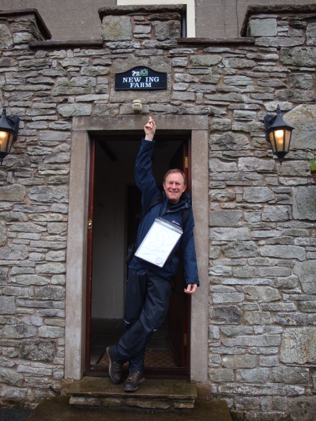 Unfortunately, the boiler had gone off overnight, so my boots were still damp from yesterday’s “swim” in the stream and the downpour that “kept me fresh” most of the day; today’s weather didn’t seem much better either. We had a super breakfast at New Ing Lodge; the young people there just can’t do enough for you. If you have to stay overnight in Shap then it’s the place for you.
Today’s walk was to be the longest so far; Martin Wainwright reckons 19.8 miles, but my GPS measured over 22, probably because my route and the one he recommends were different! With the weather being pretty unpleasant too, I started out wearing my new waterproof over trousers for the first time. And very glad of them I was too. The village of Shap has more going for it than most people give it credit for and today’s walk started with a walk south down the A6, past the recreation grounds, the Shap Open Air Heated Swimming Pool (the highest in England – motto, “Are You Brave Enough”!), a couple of small shops and pubs, including The Greyhound where we’d had a great meal last night.
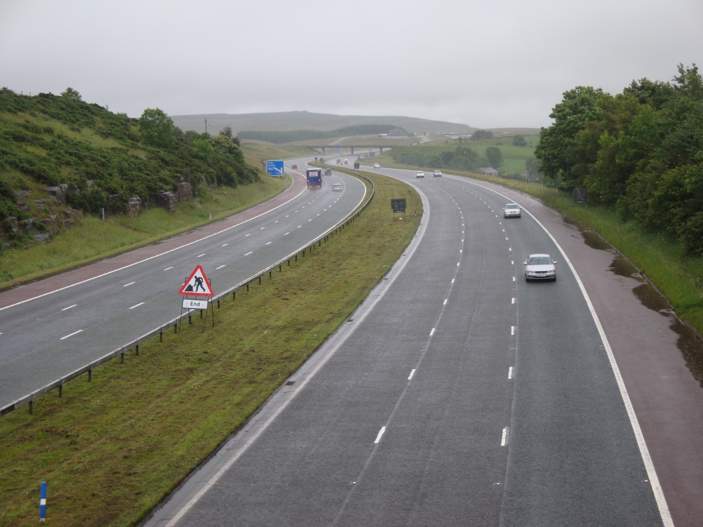 But soon I was in the country, in sight of the cement works, crossing first the West Coast main railway line and then the M6, towards the place where the access road between Hardendale Quarry and the cement works, the other side of the motorway, crosses the path. As I approached the crossing, I could hear the noise of machinery at work and, lo and behold, there was a dumper truck dropping a load of gravel into the mud for a JCB to spread and smooth down very nicely, so that I could cross without getting my boots muddy; wonderful!
There was a bit of a climb to Seal Howe, but today wasn’t a day for a lot of uphill and down dale and this was pleasantly invigorating, even as the rain came down. Bizarrely, half way up, I found a piece of paper on the path, laminated in a plastic cover. It was a prayer for walkers advising us that if we prayed to god, he would keep us safe and see that we reached Robin Hood’s Bay safely. I really, really wish that I’d photographed it as it was just so weird, but a nice thought, if you’re into all that god stuff! So, I carried it a few metres and left it on a large boulder weighed down with a stone so that it wouldn’t blow away and so that the next walker might see it.
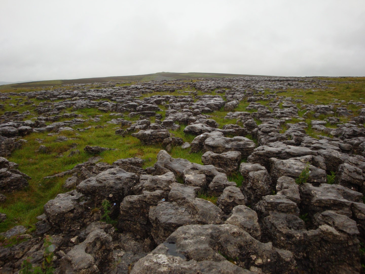 Across Crosby Ravensworth Fell and Orton Scar there were large expanses of limestone pavement which was rather photogenic. Because it was raining heavily, I kept my little Sony DSCW-170 on my belt beneath my waterproof jacket, briefly whipping it out every now and then to quickly take a photo before it got wet.
I reached Orton where, The Boss tells me, there is a wonderful chocolatier (Kennedy’s Fine Chocolates Ltd.). But the path doesn’t go through the centre of the village and, as the rain continued, I carried on along the small road which skirts it and saw a couple of very nice-looking old stone bridges; very picturesque.
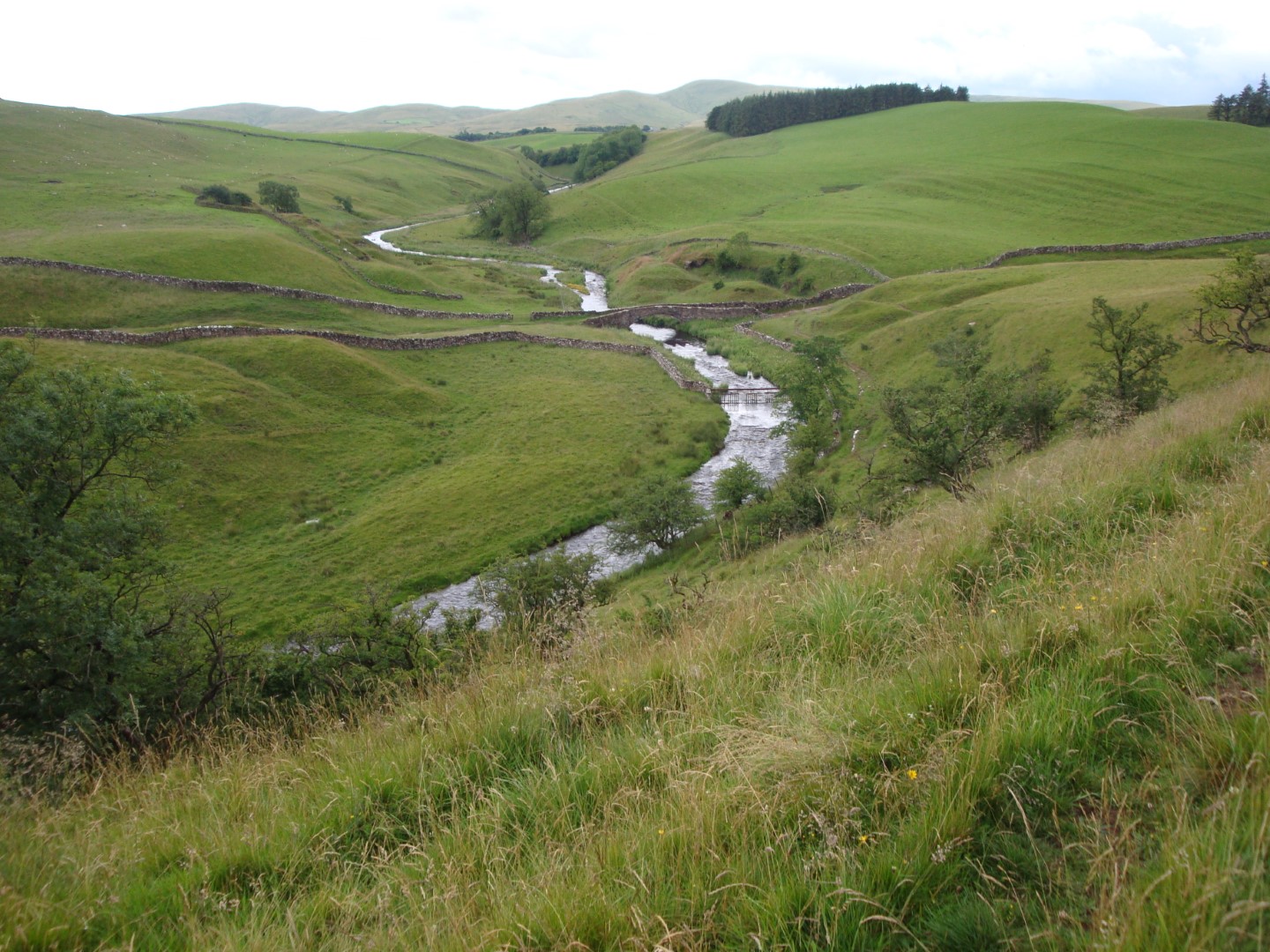
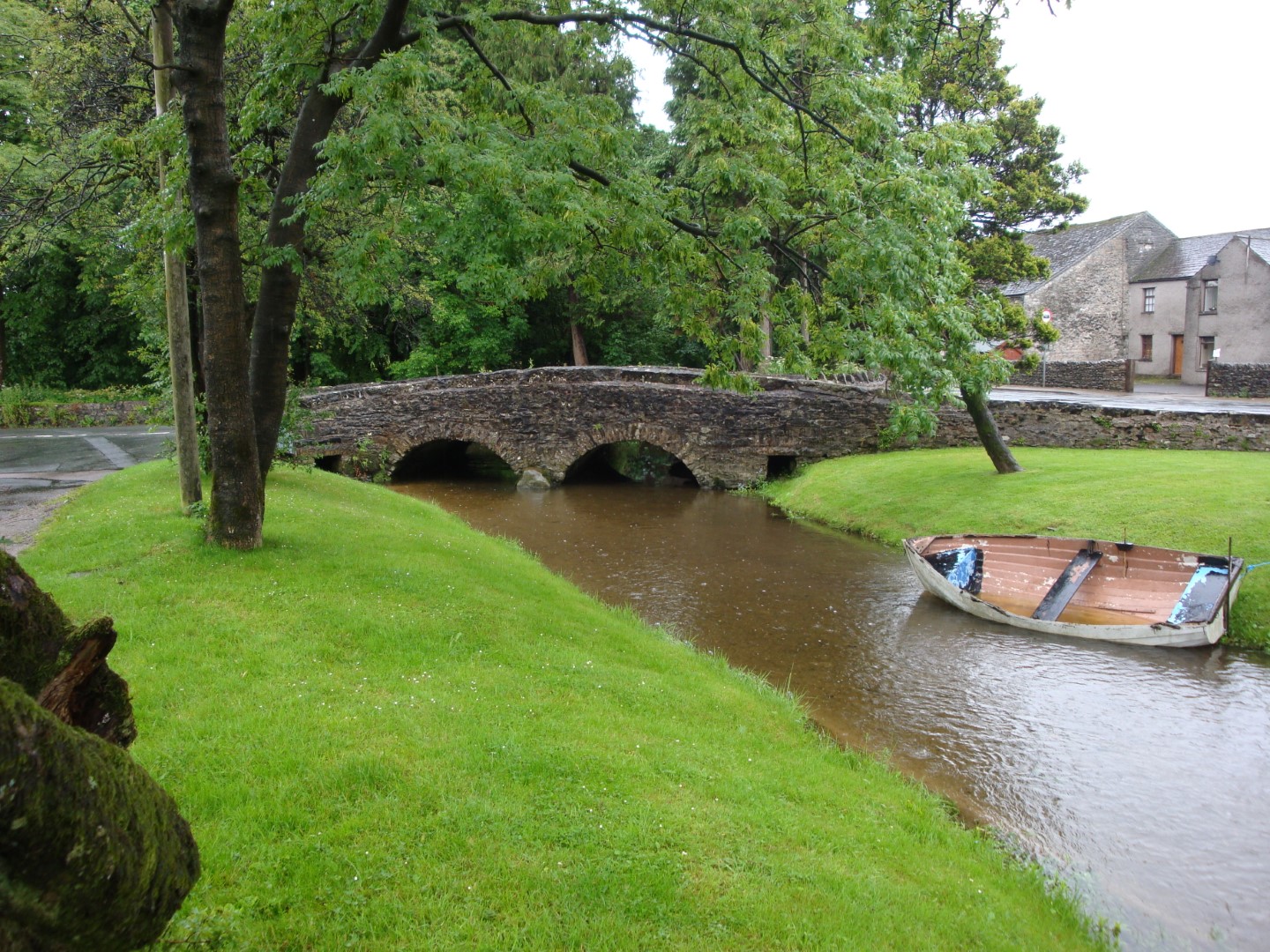 Unlike yesterday, when there was a combination of heavy rain, a howling gale and a huge climb, today, though just as wet, was at least undulating, fairly undemanding apart from the distance and overall, I actually lost height (hence “Downhill All The Way”). I stopped briefly at the second Orton Bridge (the one in the photos with the boat moored alongside the stream) for a cup of what Goughie calls “hot brown liquid” and I call instant coffee then carried on past some
  guinea fowl and onto Tarn Moor. Here, and I don’t know whether or not I should mention this (but I guess you know I will), last night’s dinner and three pints of bitter had their revenge and I had to, how can I put this nicely, “fertilise” the ground beneath a tree. But at least both my natural product and the toilet paper I always have in my rucksack (well, you never can tell, can you?) were biodegradable and I did put a big stone on top to prevent anyone else from stepping in it. As the rain had stopped by now (was it the sight of my bare bottom that had scared it away!?) I moved a little distance on and ate my butties, sitting on a rock.
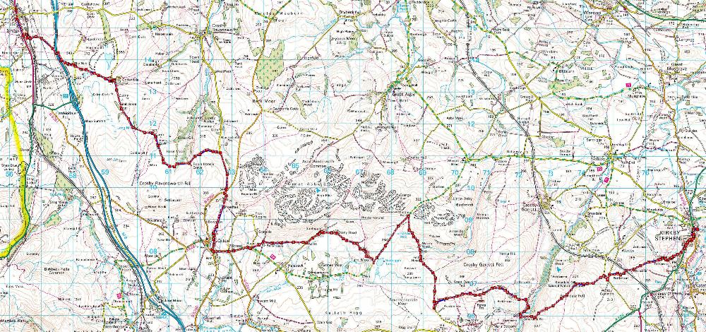
Now, the official (old) path after Tarn Moor, reaches a small road just before Sunbiggin Tarn, turns right, follows the road north for a mile or so, switches back on itself and carries on south down the road before heading east near a farm called Brackenber, just north of a little place known as Brownber, slightly north of the A685 (the red/blue route if you click on the map to the right). Altogether it’s about 5 km on road. And I don’t like walking on roads!
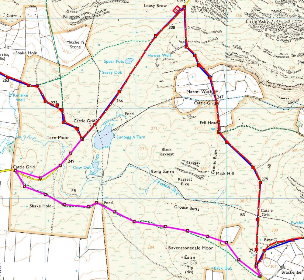 Had I read Martin Wainwright’s book better I’d have noted that a new path has been opened up, south of Sunbiggin Tarn, across Ravenstonedale Moor, joining up with the old route at Brackenber Farm (the pink route on the map). This is about 1 km less and is off-road all the way. However, not one to take short cuts I did at least get a good view of Sunbiggin Tarn which was very pleasant, especially as the rain had stopped, my waterproof trousers were in the rucksack and my waterproof jacket slung from it, ready for action! Both my GPS and the map showed another small body of water called Spear Pots, but even in weather as wet as there had been lately it was just an impression in the ground.
Scandal Beck
From Brackenber there was a small climb over the curiously named Begin Hill and then a descent to the equally oddly named Scandal Beck, crossing it at Smardale Bridge. I wonder what had gone on there in the past! Looking north along the beck I could see a rather splendid, I presume disused, railway viaduct. As I crossed Smardale Fell I looked back and in the not so far distance I could see black, black clouds and rain heading rapidly in my direction. So, I very quickly threw on my waterproofs (how wise I was to have them at the ready!), pulled the hood down low across my face and braced myself for the coming storm. It arrived very quickly indeed and in minutes I was wet all over; the outside, that is; I was still reasonably dry inside, although my boots were now damper than when I’d left Shap.
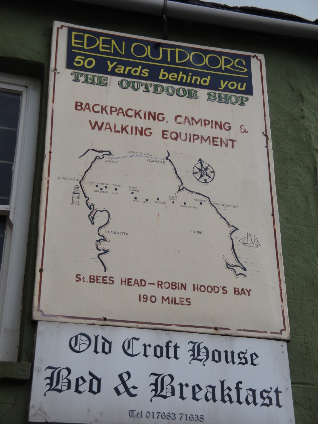 The walk into Kirkby Stephen crosses the disused railway line, of which the viaduct I’d seen a bit further back was a part, and there, beneath the bridge, were the wimpish NW Walkers, huddling against the storm and putting on their own waterproofs. I was tempted to say “G’day you bastards” but I’m not that unfriendly, even to the Aussies amongst them! So, I stopped briefly, commiserated with them and then left them to it as I headed for Kirkby Stephen. On reaching the town I realised that this was probably the biggest place I’d been in since leaving St Bees (in fact, according to Wikipedia the population of Kirkby Stephen is 1,832, whereas that of St Bees is only 1,717). The path enters the town, goes down the main street, passing a road sign with distances oddly marked in miles and furlongs (Q. how many furlongs in a mile; indeed, how many chains in a furlong?) and there, near the end, was tonight’s B&B the very idiosyncratic Old Croft House, complete with a C2C route map above its own sign.
Unfortunately, and The Boss gave me a mildly hard time over this, I’d booked a room with a non en-suite bathroom. But we did have the use of our own one across the corridor. The room was small, to say the least, and we soon completely filled it with all our stuff. The house is stuffed full of books, theatrical props, ornaments and many a weird and wonderful item. As you enter the front door there is a full suit of armour to greet you, complete with a pink handbag on its arm, presumably to welcome gay walkers! (Oh shit, I bet I’ll be in trouble for putting that!).
Despite the eccentricity of the place we were warmly welcomed by the very garrulous “lady of the house” and she provided wonderful tea with delicious cakes. The Boss and I sat in their splendid dining room for quite a while and I then got into a lovely hot bath to chase away the aches and pains of the 22-mile-long, very wet day. Afterwards I did my usual boot cleaning, GPS route down and up loading and looked at today’s photos. Boy, do they show just how damp it was! Our room was very hot, as the radiator was on; so, we opened all the windows and I put my boots on the radiator, hopefully to dry. But whilst we were out for dinner the heating went off and they were still very damp the next morning. I was getting seriously (well, sort of….) concerned that If things carried on like this much longer I’d end up with trench foot!
We took a walk around the town, especially going down to Frank’s Bridge where there are “coffin stones” on each end for the pall bearers to rest their load before carrying on to the nearby church. Now, can anyone tell me why it’s called “Frank’s Bridge”? I’ve Googled for a while without being any the wiser. Later we had dinner at the King’s Arms, just across the road from the B&B, and then back to our accommodation for a very good night’s sleep.
Tomorrow morning, Goughie is driving is driving up from Bolton to join me for the next two legs. Although, as I’ve said before, I quite enjoy walking on my own, it’s good to have a friend with you sometimes and I was looking forward to his arrival.
The mystery of the name of Frank’s Bridge continued to nag me. So, I eventually contacted the Kirkby Stephen Tourist Information Centre and a very helpful guy called Barry almost immediately e-mailed me with an explanation which seems pretty good to me. And even if it isn’t the correct story it’s at least a good one!
“Hello John,
Briefly one story regarding Frank’s Bridge is that the Brewery that was by it used to be run by head brewer Frank Metcalfe who lived across the river Eden on the far side and crossed the Ford by stepping stones; after a hard days quality control of his products he inevitably fell in on the return journey and after many times commissioned a bridge to keep his feet dry!
Regards,
Barry
Kirkby Stephen Tourist Information Centre
Market Square
Kirkby Stephen
Cumbria CA17 4QN
England”
| Accommodation | Beverages & Comestibles |
|---|---|
| Old Croft House Market Street Kirkby Stephen Cumbria CA17 4QW http://www.theoldcrofthouse.com 017683 71638 | Tomato and Basil Soup Chilli Con Carne Rice Chips (Pretty naughty but 7/10 nice!)) Black Sheep and Dent Bitters, Dent Aviator (3 pints in all - very good!) |
Some Day 05 Photos


